

River
River
The Taravo: a wild river
The Taravo: a wild river
River
River
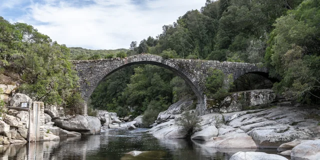
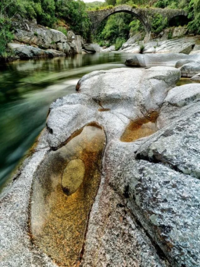
The Abra Bridge - Taravo
The Abra Bridge - Taravo
|
dr
- Taravo and its history
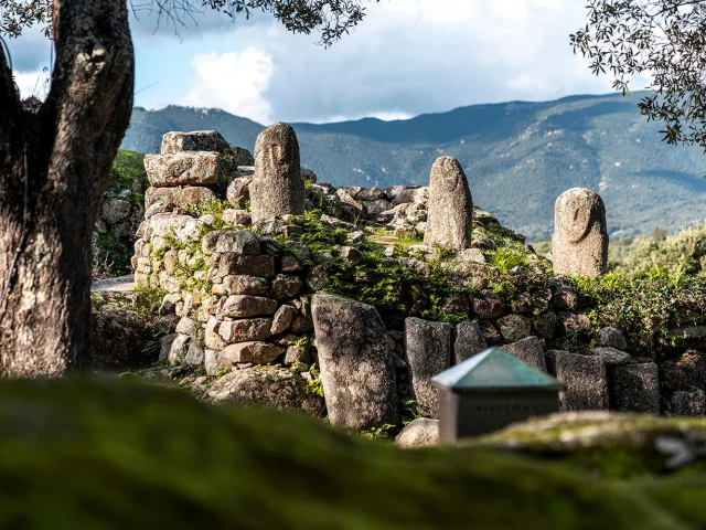
Its catchment area of around 490 km² covers 31 communes and is entirely part of Hercynian Corsica, characterised by a bedrock dominated by granitoids. Since prehistoric times, an agro-pastoral society has developed here, as evidenced by the Filitosa site, evolving towards an agro-sylvopastoral organisation with, from the 15th century, the emergence of structuring villages in the upper valley, dividing their activities between the mountains and the plains. At the end of the eighteenth century, a class of landowners established themselves for the long term and gained political power, before the demographic surge of the nineteenth century profoundly transformed the space and social dynamics of the upper valley, where the population doubled to almost 8,000 inhabitants at the beginning of the twentieth century. At the same time, the lower valley became more settled and individualised through the division of land and the creation of separate communes. In the twentieth century, particularly after the First World War, the mountains were marginalised, leading to rapid de-urbanisation and a transformation of the landscape marked by the expansion of the maquis. However, the Taravu basin still retains a strong sense of geographical, environmental, historical, human and economic coherence, with a sense of community that is still very much alive, making a territorial approach to this valley more relevant than ever.
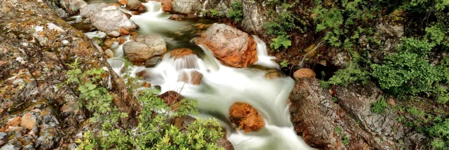
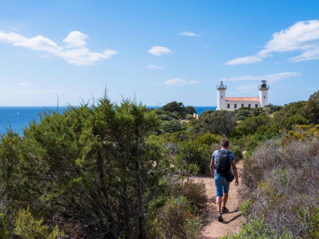
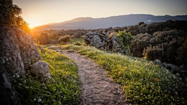
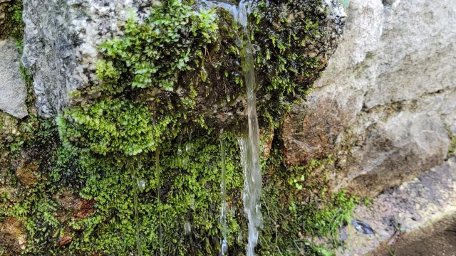
- The wild character of the river
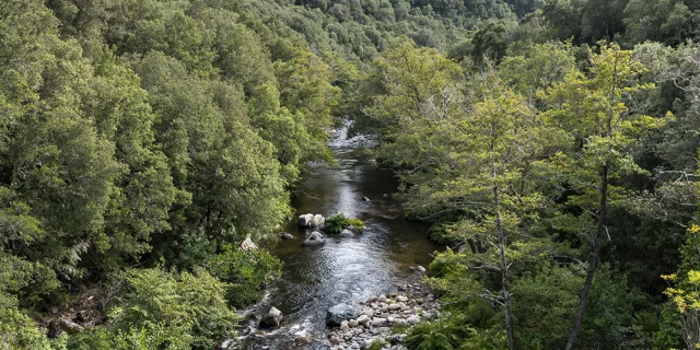
The Taravu flows through a mosaic of natural woodland and scrubland and extensive agricultural areas. Most of the river’s course is dominated by woodland and scrub, the variability of which reflects the natural gradation of vegetation, from the sub-alpine to the thermo-Mediterranean levels. Only the alluvial plain, which forms the most downstream part, is largely occupied by grazed meadows. A few plots of vines and rare areas of gardens and/or housing complete this mosaic, although they do not occupy a large area. The overall landscape is relatively homogenous, regularly interspersed with erosion-resistant granite layers that form rocky spurs on the hillsides and gorges along the river. These different environmental contexts define contrasting sections in terms of both physical (hydrodynamics, sediment regime, etc.) and biological (nature of the riparian vegetation, ecological potential, etc.) characteristics.
The whole of the Taravu (with the exception of the river mouth) is favourable to the development of the trout: as such, the Taravu has the characteristics of a 1st category fish river. It should also be noted that several sections of the Taravu’s tributaries are strictly off-limits to fishing, in order to protect the macrostigma trout, which is emblematic of Corsica.
The Taravu catchment area incorporates or intersects a wide variety of natural areas of high environmental value, including six * ZNIEFF type I areas, five * ZNIEFF II areas and five Natura 2000 sites (* Natural areas of ecological, faunistic and floristic interest).
The Parc Naturel de Corse covers around 20,500 hectares (around 6% of the total surface area of the PNRC) and covers 11 communes in the Haut and Moyen Taravu. As a result, a large number of plant and animal species thrive in the catchment area. These include plants, trees and shrubs, birds, reptiles, amphibians, insects and mammals. Many species are endemic, rare, protected and often all three!
What’s more, since 2017, the Taravu river has been awarded the “Wild River Sites” label by a scientific committee, testifying to the valley’s well-preserved and balanced character.
In France, only 7% of water bodies are of “very good ecological status” as defined by the Water Framework Directive (WFD), and it is estimated that less than 1% of rivers can be described as “wild”.
The main aim of the “wild river sites” label is to serve as a tool for managers of running water aquatic environments to improve the protection and conservation of rivers that are functioning ecologically.It incorporates the following concepts
Quality of the state of preservation of the ecosystem;
Recognition and reward of local players for exemplary river management;
Enhanced protection, over and above the regulatory objectives set out in the WFD (achievement of “good status”, classification, etc.);
Collective will, shared in the action of preservation (governance);
Strong economic value of the river (ecosystem services, attractiveness of the area);
Enhancement of the area as part of a network.
It therefore serves to develop both a mark of recognition by the public (environmental quality), a distinction for managers (fishermen, nature park, etc.) and a collective enhancement of an exceptional area!
This is a French label, which is currently being translated and extended to European level.To protect its unspoilt nature and environmental richness, the Taravu was the first Corsican river to receive this distinction in February 2017: a level 2 “Wild Rivers Site” label. From then on, this was part of a strong territorial project, with an action programme aimed at preserving the Taravu, but also at developing its valley, a major conservation area.
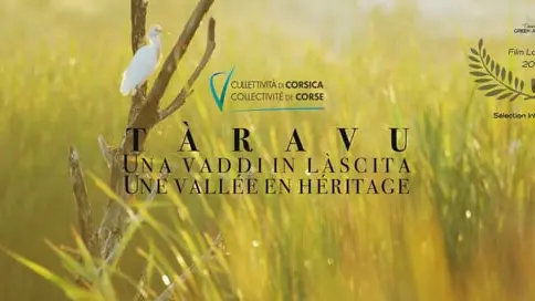
Since then, a number of initiatives have been carried out to raise awareness of the issues involved in restoring water quality in the catchment area, and to highlight the importance that local people attach to protecting their river. To reinforce these actions, the film “Taravo: a Heritage Valley” and various natural site developments have been produced, making this river an attractive area for sustainable development.
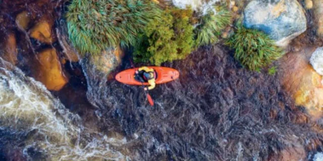
An ideal itinerary for nature lovers, freshwater swimmers, hikers and those who enjoy a contemplative break in an unspoilt setting. Let yourself be carried away by the gentle flow of this little-known but absolutely unforgettable Corsican river.
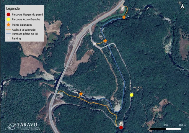
Taravo River Map
Taravo River Map
Activities and gourmet breaks
in the Taravo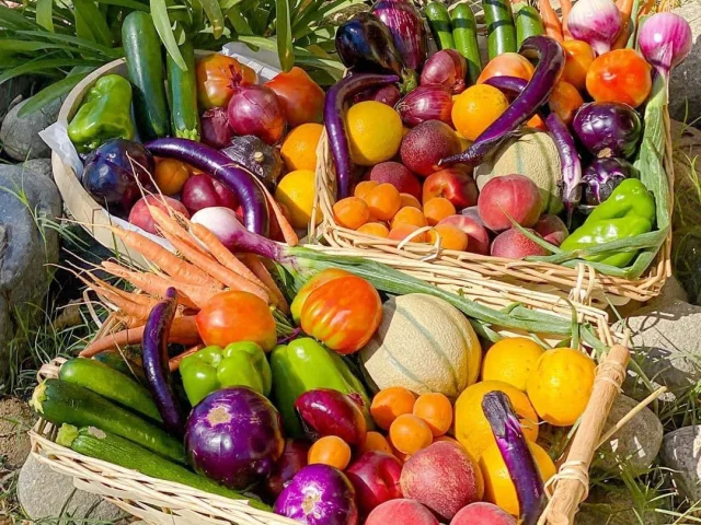
- Share